On Tuesday 29th of May 2018 we operated portable from Gummer’s How, SOTA G/LD-050.
HF and VHF equipment was used and members from the Furness Amateur Radio Society joined us.
Directions
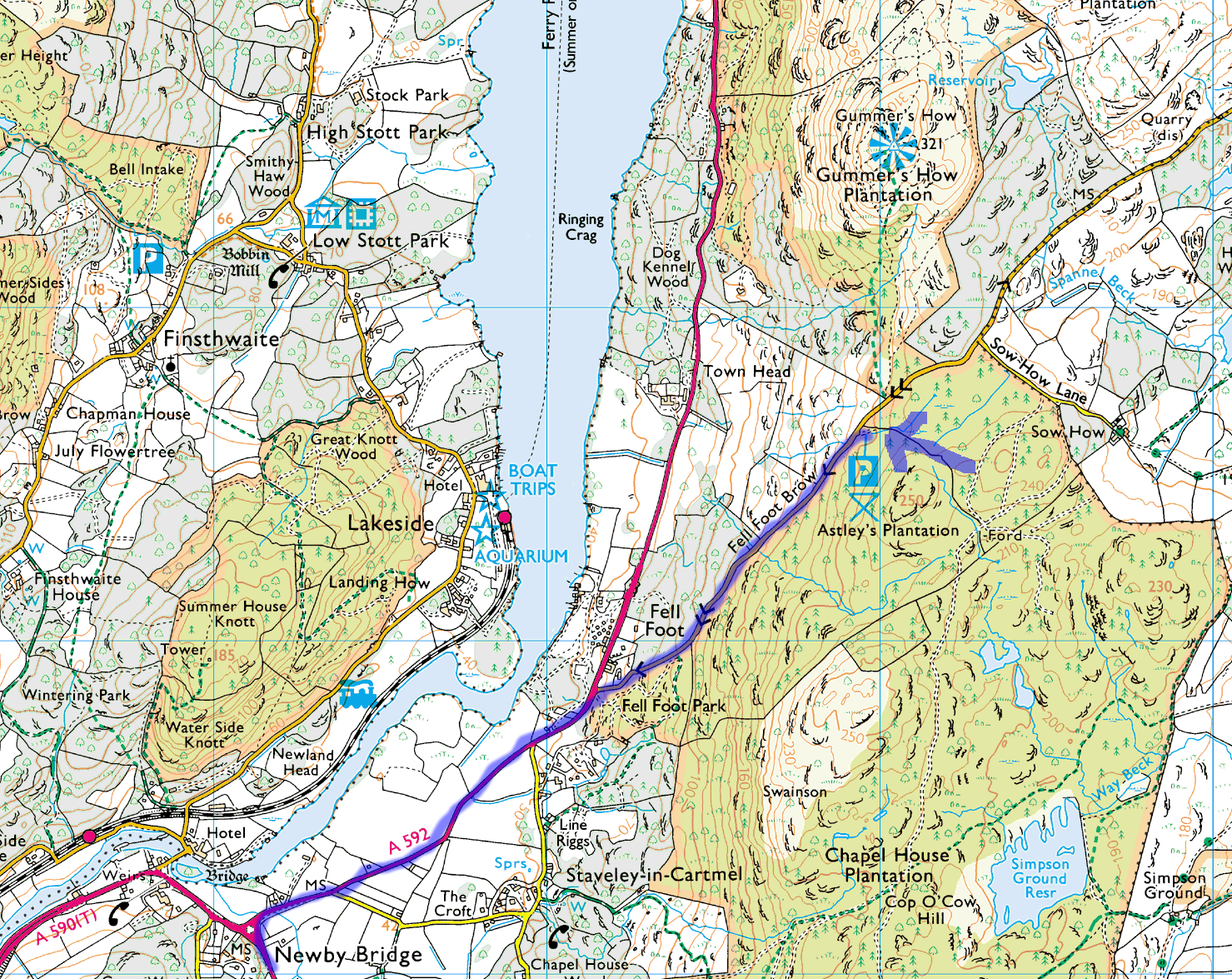
Gummer’s How is located at the South end of Lake Windermere approximately 1km from the Fell Foot National Trust Park.
From the Lancaster/Morecambe area you would take the M6 North to Junction 36, then follow the A590 initially to Kendal and then the slip to the left, still the A590 to Barrow. When you reach the Newby Bridge Roundabout you take the A592 to Windermere and the turning to Gummer’s How is signposted at around 1/2 a mile. Take the right-hand turning then park in the car park which is about 1 mile up the hill. We met there at 7pm.
The Ascent
The walk up Gummer’s How is around 1km long with an ascent of 100m via a footpath and stone steps. The track shown below follows around the Eastern side of the hill to avoid the trickier direct path.

The Views
The views from Gummer’s How are impressive given the modest 100m ascent. The following computer generated 360 degree panorama has all the visible summits listed.

SOTA
If you would like to try your hand at a Summits on the Air activation you will need to register with the SOTA Database website to record your activation (this can be done after the event) and the SOTAwatch website if you’d like to post an Alert and self-spot when there (however, M0NOM will be posting an alert so chasers will know we are there).